Planys conducted underwater visual inspection, sounding and 3D SONAR survey of a critical highway bridge in West India. The bridges piers had been severely scoured around the bed over the past 50 years exposing the bed-rock thus making it impossible for human divers to perform inspection (depth ~ 20m). Further, one the piers in the middle of the bridge had tilted and an urgent inspection was recommended to evaluate the extent of damage and plan rehabilitation accordingly.
Planys conducted underwater visual inspection, sounding and 3D SONAR survey of a critical highway bridge in West India. The bridges piers had been severely scoured around the bed over the past 50 years exposing the bed-rock thus making it impossible for human divers to perform inspection (depth ~ 20m). Further, one the piers in the middle of the bridge had tilted and an urgent inspection was recommended to evaluate the extent of damage and plan rehabilitation accordingly.
Scope of Work: Visual Inspection, sounding and 3D SONAR survey of 6 piers
Planys Solution: The inspection was performed using Planys’ ROV Orca equipped with high resolution camera, echosounder, 3D SONAR, depth sensor & was deployed from a boat.
- Over 90 anomalies were identified and categorised into minor, moderate & major based on the size that included cracks, surface deformations, pinholes, corrosion.
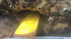
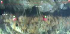
- It was found that one of the piers alone had more than 50% of the observed anomalies and had heavy scouring at bed (bed rock exposed), hence tilting it sideways. The pier also had a large horizontal crack at the bottom at a water depth of 20m. This was verified in both visual inspection and 3D SONAR survey.
- Site engineers could see the inspection in live streaming and were able to understand the extent of the damages.
- Planys’ proprietary image enhancement algorithm was used to enhance the videos taken in the extremely turbid waters
- All anomalies/defects were plotted against geo-tagged CAD drawing of every section on the Planys Analytics Dashboard (PAD) with localised click-to-view video.
- Due to the high risk and as a precaution, the authorities closed down the bridge
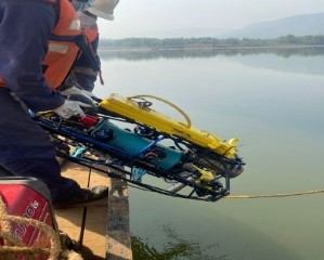
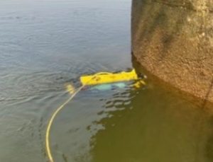
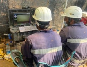
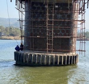
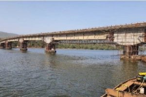
Images show deployment & site setup of the ROV system during inspection
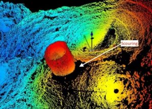
3D SONAR image showing horizontal crack and extent of Scour
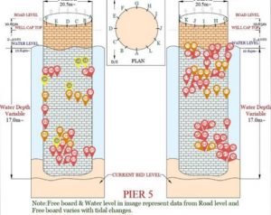
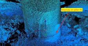
“Hot-spot” map showing anomalies on the damaged pier the bridge