
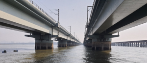
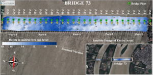
Planys conducted underwater visual inspection (level 2) of well foundations and bathymetry survey of riverbed for two 40-year-old railway bridges in West India. The bridges had thick marine growth and was in extremely turbid waters, thus making it impossible for human divers to perform inspection. Further, due to tidal variation, only got a 2-hour window per day was available.
Scope of Work: Level 2 inspection (cleaning and visual inspection) of 76 well foundations of 2 railway bridges of 2km of length each and bathymetry survey on either side of the bridges
Planys Solution: The inspection was performed using Planys’ ROV Beluga and ROV Orca equipped with high resolution camera, turbid water module, altimeter, depth sensor & was deployed from a boat.
- Over 130 anomalies were identified and categorised into minor, moderate & major based on the size of the defects that included exposed rebars, cracks, honeycombing, surface deformations, pinholes, and corrosion.
- Bathymetry was performed by the ROV at an offset of 30m on each side of the bridge with 5m track line interval.
- Planys’ proprietary image enhancement algorithm was used to enhance the videos taken in the extremely turbid waters
- All anomalies/defects were plotted against geo-tagged CAD drawing of every section and the bathymetry data was presented in 2D and 3D plots on the Planys Analytics Dashboard (PAD) with localised click-to-view video.
- The report also included customized suggestions for remedial measures to be taken further for repairs.
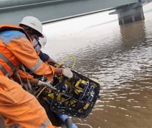
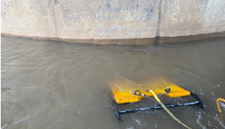
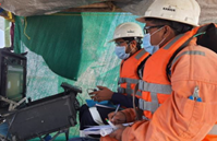
Images show deployment & site setup of the ROV system during inspection
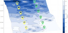
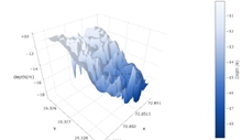
Figures show 2D contour map of the bathymetry survey embedded on satellite image, 2D contour plot and 3D plot of separate sections of the bridges