
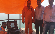
Planys executed underwater visual inspection of the upstream face and bathymetry survey at a large and crucial dam in South India. The site had crocodiles which made manual inspections impossible. ROV Beluga was deployed from the dam for this inspection and this vast operation involving over 445+ dives and bathymetry survey was meticulously planned and completed smoothly within a 3 weeks’ time period.
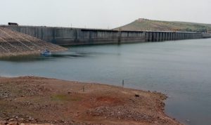
Scope of Work: Underwater visual inspection of upstream face of a large dam consisting of 54 blocks to be inspected and bathymetry survey upto 100m from the upstream face.
Planys Solution: The inspection was performed using Planys’ ROV Beluga equipped with high resolution camera, GPS, SONAR, altimeter and depth sensor.
- Over 150 anomalies were identified and categorised into minor, moderate and major based on the size of the defect that included cracks, surface deformations, pinholes and debonding between layers.
- Bathymetry was performed by the ROV by breaking the area down into grids of 10x10m
- All anomalies/defects were plotted against geo-tagged CAD drawing of every section on the Planys Analytics Dashboard (PAD) with localised click-to-view video feature.
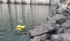
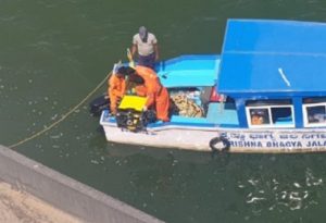
Images show deployment & site setup of the ROV system during inspection
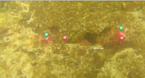
Image shows dimensions extracted with Planys ROV of cavity at one of the blocks of upstream face
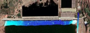
Contour map from the bathymetry survey