Services
Ports & Terminals
CASE STUDY
JETTY/TERMINAL PILE INSPECTION
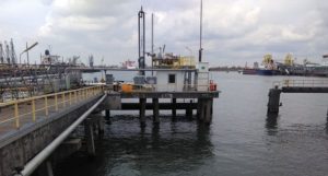
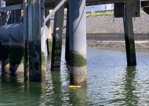
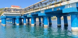
Planys conducted underwater inspection of an oil and gas terminal in Rotterdam. The terminal is used for berthing vessels to move hydrocarbon products. Inspection with divers was unsuitable due to safety risks associated with the practice. Further, some of the piles had corrosion protection wrapping/insulation and it was not desired to remove the same for corrosion mapping. Planys was asked to explore sophisticated underwater NDT methods of assessing corrosion in the piles without exposing the bare surface to evaluate the risk and suitably plan for rehabilitation.
Scope of Work: Underwater visual inspection, thickness measurements (by waterjet cleaning & ultrasonic thickness (UT) measurement) & corrosion monitoring (without cleaning using PEC) at 3 jetties in the same terminal.
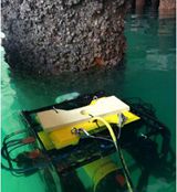
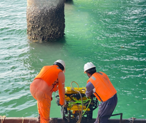
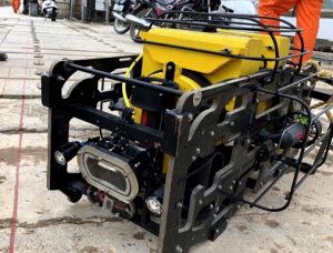
Planys Solution: The visual inspection was performed using Planys' ROV Beluga equipped with high resolution camera, high pressure water-jet cleaning nozzle, Ultrasonic thickness measurement probe and Pulse Eddy Current Probes on a gimbal mount.
- Over 150+ PEC and 80+ UT measurements were taken across the 3 jetties.
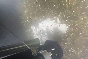
- High pressure water jet cleaning pump and nozzle mounted on the ROV was used to clean the soft marine growth from the pile and ROV was maneuvered to touch the structure with a contact ultrasonic thickness measurement probe.
- Following a calibration phase of PEC, the ROV was navigated to the surface of interest and measurements were recorded. Results obtained were benchmarked against those from a conventional UT survey performed by professional divers 2 years back. The overall condition of the jetty, in the presented case, was assessed to be healthy.
- PEC was found to have great advantages over conventional UT as there was no need to remove insulation or coatings & also it eliminated the need for cleaning of marine growth. PEC was found to be 3 times faster than conventional UT.
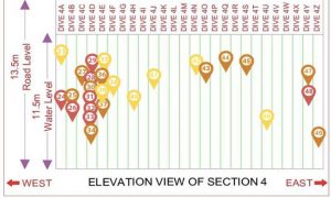
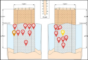
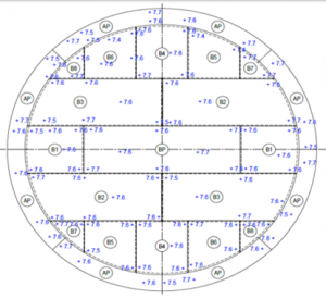
- All data sets were plotted against geo-tagged CAD drawing of every pile at every jetty on the Planys Analytics Dashboard (PAD) with localised click-to-view video feature.
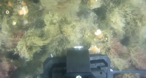
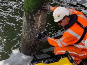
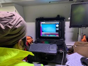
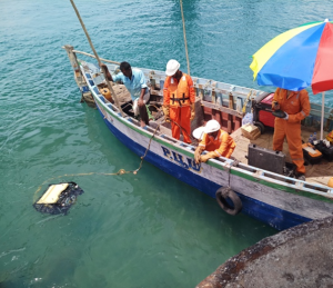
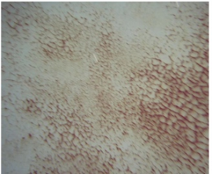
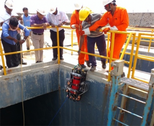
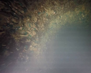
Images captured during PEC measurements being performed by the ROV without cleaning
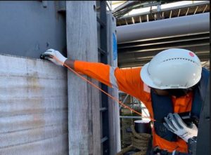
Images captured during the calibration phase of the inspection for the following techniques pulsed eddy current & conventional UT
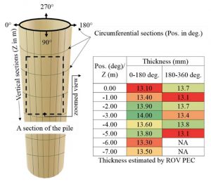
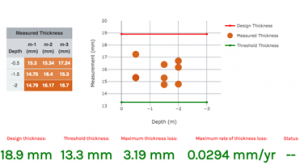
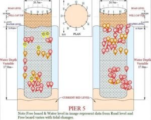
Figures shows measurements displayed on Planys Analytics Dashboard (PAD) & Consolidated thickness estimated using the ROV-PEC system
CASE STUDY
DUE-DILIGENCE SURVEY OF A NEWLY CONSTRUCTED BERTH
Planys conducted underwater inspection for a newly constructed berth in South India. Prior to release of payment, a post-construction due diligence was to be conducted to provide visual evidence of the work completion to the port consultant.
Scope of Work: Visual inspection of two berths of 700m each having piles of maximum depth of 17m. The inspection aimed to identify locations of exposed geo-textile layer, exposure of re-bars on earth retaining structure (ERS), absence of boulders on the slope protection works/rock bund and presence of any other construction defects.
Planys Solution: The inspection was carried out by Planys' ROV Beluga equipped with high resolution camera, turbid water module, altimeter and depth sensor.
- Over 120+ construction defects were found, locations of rebars exposed, geo-textile layer exposed and at several sections on the slope, boulders were found missing.
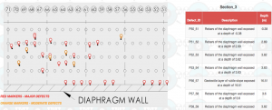
- Defects were categorised by severity (major/moderate/minor) and also by type (cavity/rebar exposed, stone missing) marked on construction drawing.
- All anomalies/defects were plotted against geo-tagged CAD drawing of every section on the Planys Analytics Dashboard (PAD) with localised click-to-view video feature. The report was given to the consultant for further suggestions and relevant action point for re-work.
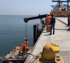

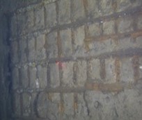
Images show deployment & setup of the ROV system and defects captured during inspection
Images show defects captured during inspection with Planys ROV & snapshot of the “defects hot-spot” map delivered to client for a certain section on Planys Analytics Dashboard (PAD)
CASE STUDY
UNDER-BERTH SURVEY
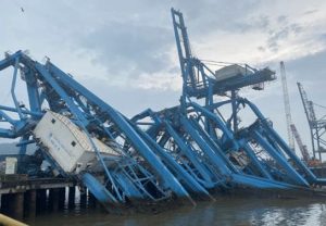
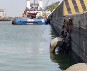
Planys conducted underwater inspection for the under-side of a berth at a port in western India. After a cyclone, 3 cranes collapsed on the berth and parts of the crane pierced the berth at different locations. Due to low clearance caused by tidal variation and berth height, it was an unsafe environment to send human divers to examine the extent of damage.
Scope of Work: Inspection of a section of the berth from the under-side (dry region) to assess the damage to the berth/deck/slab due to crane collapse. The inspection aimed to identify locations of structural defects on the under-side.
Planys Solution: The inspection was performed using Planys' ROV Beluga equipped with high resolution camera (facing upwards), turbid water module, LASER scaler and depth sensor.
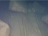
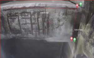
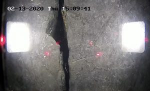
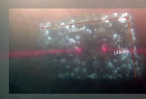
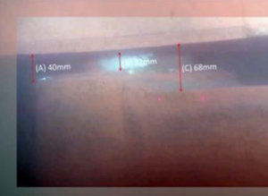
- Over 100+ major defects were found - rebar exposed, beam-bulging, cracks & spalling.
- Dimensions of the extent of defects was extracted using Planys’ unique LASER scaler.
- All anomalies/defects were plotted against geo-tagged CAD drawing of every section on the Planys Analytics Dashboard (PAD) with localised click-to-view video feature. The report was given to the consultant for further action on dismantling of crane/rehabilitation of berth.
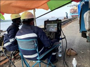
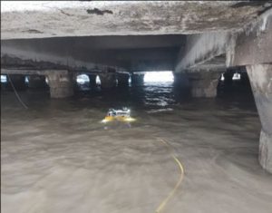
Images show deployment & setup of the ROV system and defects captured during inspection
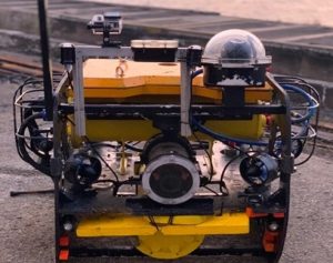
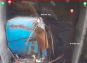
Photo shows ROV fitted with camera, defects captured during inspection & snapshot of the
“defects hot-spot” map delivered to client on Planys Analytics Dashboard (PAD)
CASE STUDY
SIDE SCAN SONAR SURVEY UNDER BERTH
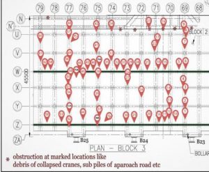
Planys conducted underwater SONAR survey for a berth at a finger jetty in South India. As an aftermath of cyclone Vardah that hit the eastern coast of India in early December 2016, it was suspected that the wrecked sunken remains of moderate to large size would have accumulated at the finger jetty. The survey was aimed at identifying sunken objects and major obstacles on the sea-bed close to the finger jetty and geo-tag the locations for concerns on a map for further action by the client.
Scope of Work: Visual inspection for identifying any medium to large unwanted sunken objects and abnormalities on the seabed profile around the finger jetty. The scope of work included Side Scan imaging of the berth at finger jetty up to a distance of 10m on both northern and southern side of the platform.
Planys Solution: The survey was performed using Planys' Remotely Operated Vehicle (ROV) Beluga equipped with high end Side-Scan SONAR, GPS, altimeter and depth sensor.
- Acoustic imaging for the areas of interests was completed using ROV Beluga.
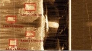
- Figures below show the swath covered by Side-scan SONAR system and the location of major objects observed around the berth.
- Results were finally tabulated and compiled on the Planys Analytics Dashboard (PAD).
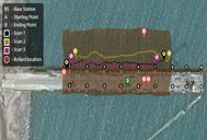
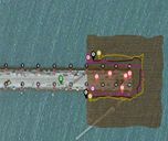
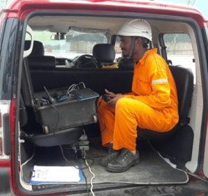
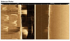
Some Side Scan SONAR images : Objects at the seabed, in between the piles, towards port side at 11.3m of depth
CASE STUDY
DUE-DILIGENCE SURVEY UNDER NEWLY CONSTRUCTED BERTH
Planys conducted underwater inspection for a newly constructed berth in South India. Prior to release of payment, a post-construction due diligence was to be conducted to provide visual evidence of the work completion to the port consultant.
Scope of Work: Visual inspection of two berths of 700m each having piles of maximum depth of 17m. The inspection aimed to identify locations of exposed geo-textile layer, exposure of re-bars on earth retaining structure (ERS), absence of boulders on the slope protection works/rock bund and presence of any other construction defects.
Planys Solution: The inspection was carried out by Planys' ROV Beluga equipped with high resolution camera, turbid water module, altimeter and depth sensor.
- Over 120+ construction defects were found, locations of rebars exposed, geo-textile layer exposed and at several sections on the slope, boulders were found missing.
- Defects were categorised by severity (major/moderate/minor) and also by type (cavity/rebar exposed, stone missing) marked on construction drawing.
- All anomalies/defects were plotted against geo-tagged CAD drawing of every section on the Planys Analytics Dashboard (PAD) with localised click-to-view video feature. The report was given to the consultant for further suggestions and relevant action point for re-work.


Images show deployment & setup of the ROV system and defects captured during inspection

Images show defects captured during inspection with Planys ROV & snapshot of the “defects hot-spot” map delivered to client for a certain section on Planys Analytics Dashboard (PAD)
CASE STUDY
PORT WALL INSPECTION
Planys conducted underwater inspection of a port wall at a major port in West India. The dock worked on a lock-gate system through which vessels could enter and leave at any state of tide. Visual inspection and side scan survey was performed along the port walls to evaluate the defects in the wall, estimate the debris at the bottom and plan for rehabilitation.
Scope of Work: Underwater visual inspection of two walls of length 230m each up to a depth of 8m using turbid water module. The inspection aimed to identify locations of structural defects and debris at the bottom.
Planys Solution: The inspection was performed using Planys' ROV Beluga equipped with high resolution camera, turbid water module, altimeter and depth sensor.
- Over 100+ defects were found, major cavity, cracks, debonding, small cavities
- Defects were categorised by severity (major/moderate/minor) and also by type (cavity/debonding/cracks) marked on construction drawing.
- Since the water was murky, Planys’ turbid water module was used along with its proprietary image enhancement software to reduce cloudiness in the videos.
- All anomalies/defects were plotted against geo-tagged CAD drawing of every section on the Planys Analytics Dashboard (PAD) with localised click-to-view video feature.
- The report was given to the consultant for further suggestions and relevant action point for re-work.
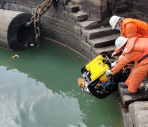
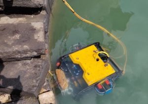
Images show deployment & setup of the ROV system and defects captured during inspection
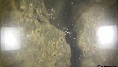
Images show defects captured during inspection with Planys ROV & snapshot of the “defects hot-spot” map delivered to client for a certain section on Planys Analytics Dashboard (PAD)
CASE STUDY
QUAY WALL INSPECTION
Planys conducted underwater inspection of quay walls for a local municipality in Netherlands. The quay walls form the lock gate arrangement to maintain water level upstream and also allow for movement of boats. It was undesirable to undertake inspection with divers due to safety risks associated with the practice.
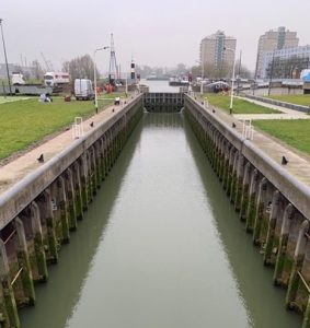
Scope of Work: Visual inspection and thickness measurements (by waterjet cleaning & ultrasonic thickness (UT) measurement) at 5 quay walls using robotics.
Planys Solution: The inspection was performed using Planys' ROV Beluga equipped with high resolution camera, high pressure water-jet cleaning nozzle, Ultrasonic thickness measurement probe and depth sensor.
- Over 500+ UT measurements were taken across the quay walls
- High pressure water jet cleaning pump and nozzle mounted on the ROV was used to clean the soft marine growth and ROV was maneuvered to touch the structure with a contact ultrasonic thickness measurement probe.
- All data sets were plotted against geo-tagged CAD drawing of every pile at every location on the Planys Analytics Dashboard (PAD) with localised click-to-view video feature.

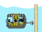
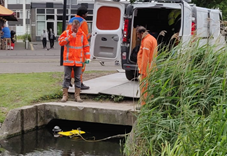
Photographs captured during ROV inspecting the quay wall, schematic showing the setup and first person camera view of UT probe touching the quay wall.
Figures shows consolidated thickness measurements at a particular location measured against design thickness, threshold thickness on Planys Analytics Dashboard (PAD).
CASE STUDY
EPC SUPPORT INSPECTION AT NEWLY CONSTRUCTED BERTH
Planys conducted underwater inspection at a rock-bund slope area for a newly constructed berth in South-eastern India. Prior to release of payment, a post-construction due diligence was to be conducted to give visual evidence of work completion to the port consultant/contractor. Divers were unsuitable due to confined area & risk of oxygen hose getting entangled in the debris.
Scope of Work: Underwater visual inspection of 200m of rock bund area below the berth to assess the gaps in the rocks layer out on the slope & presence of any debris/anomaly.
Planys Solution: The underwater inspection was performed using Planys' ROV Beluga equipped with high resolution camera, turbid water module, altimeter and depth sensor.
- Over 60+ anomalies, majorly gaps in rocks & debris were found at several sections on the slope.
- Defects were categorised by severity (major/moderate/minor) and also by type marked on construction drawing. Dimensions of defects were also extracted using LASERs
- All anomalies/defects were plotted against geo-tagged CAD drawing of every section on the Planys Analytics Dashboard (PAD) with localised click-to-view video feature.
- The results showcased on the dashboard helped the client take efficient decisions
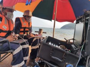
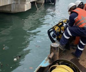
Images show deployment & setup of the ROV system during inspection
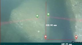
Images shows defects captured during inspection with Planys ROV & snapshot of the “defects hot-spot” map delivered to client for a certain section on Planys Analytics Dashboard (PAD)
CASE STUDY
SHIP INSPECTION
Planys conducted underwater inspection (In-water Survey/UWILD) for a large ship in South India of a port wall/dock at a major port in West India. Detailed visual inspection of underwater parts of the vessel during its berthing position was performed to avoid a dry-docking.
Scope of Work: Underwater visual inspection of hull, rudder, propeller, anodes, sea chest etc.
Planys Solution: The inspection was performed using Planys' ROV Beluga equipped with high resolution camera, turbid water module, altimeter and depth sensor.
- Over 10+ minor anomalies were identified that included propeller blade chip, anode dimension check, rudder clearance check and sea chest inspection. Overall, it was found to be in order and dry docking was avoided successfully by the clients.
- Planys’ proprietary image enhancement algorithm were used to enhance the videos taken in the turbid waters
- All anomalies/defects were plotted against geo-tagged CAD drawing of every section on the Planys Analytics Dashboard (PAD) with localised click-to-view video feature.
- The report was given to the Class surveyor for further relevant action.
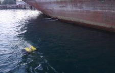
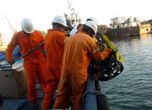
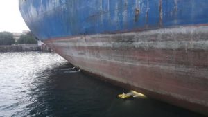
Images show deployment & setup of the ROV system and defects captured during inspection
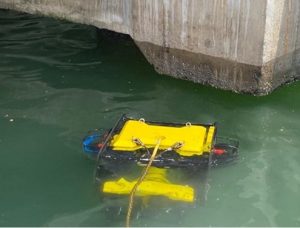
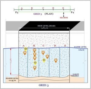
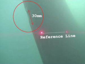
Images show dimensions extracted with Planys ROV of anode, thruster clearance and sea chest inspection
CASE STUDY
SHIP INSPECTION
Planys conducted a routine underwater inspection of a Coal and Liquid Jetty piles in West India. The client was not interested to clean the thick marine growth on the piles (typically required for traditional NDT) due to costs and risks involved. Thus, a very sophisticated underwater corrosion monitoring NDT technique was integrated with Planys ROV Beluga to assess the condition of 75+ piles taking close to 1000+ readings across 500+ locations without marine growth cleaning.
Scope of Work: Underwater NDT of 75+ piles at a Chemical Terminal
Planys Solution: The inspection was carried out by Planys' ROV Beluga equipped with high resolution camera, advanced NDT probe, altimeter and depth sensor.
- Planys ROV Beluga was re-engineered to hold manipulator arms & integrated with an advanced NDT technique for thickness loss estimation for a steel pile.
- This technique did not require the cleaning of the marine growth and thus making the overall inspection cost effective and 3 times faster than traditional methods.
- Over 50 locations had more than 30% drop in jetty pile wall loss from design/as-built thickness, 130+ locations had between 15-30% drop while the rest were in acceptable range.
- The captured data was plotted on a point summary chart where design thickness and different thresholds were marked.
- All anomalies/defects were plotted against geo-tagged CAD drawing of every section on the Planys Analytics Dashboard (PAD) with localised click-to-view feature.
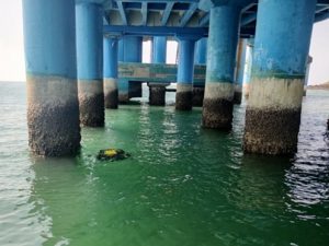
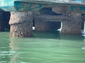
Images show deployment of the ROV system during inspection and extent of thick marine growth
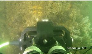
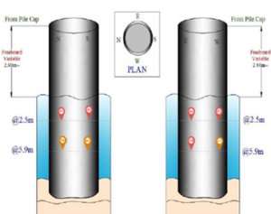
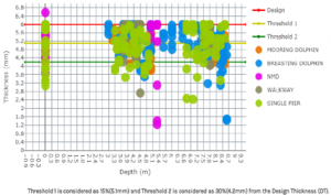
Images of from ROV Camera showing NDT probe touching the marine growth, snapshot of PAD showing “Thickness data hot-spot” map and consolidated thickness summary chart

Dams
CASE STUDY
INSPECTION OF GATE AND TUNNEL
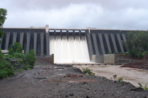
Planys conducted visual inspection of several aspects of a dam in South India. Flow of water and presence of debris in the tunnels poised challenges along with high suctions areas due to leakages. Also the depth of water was beyond 30m; thus sending human divers to perform this inspection was not possible.
Scope of Work: Underwater visual inspection of the emergency gate, 2 x sluice gates & a 4m long concrete tunnel (located between the emergency gate & sluice gate no.1) and their corresponding service gates and the inner face of the service gates located at the depth of 50 m
Planys Solution: The inspection was performed using Planys' ROV Mike equipped with high resolution camera, altimeter and depth sensor.
- Over 75 anomalies were identified and categorised into minor, moderate and major based on the size of defects that included cracks, debris, suction in some area suggesting leakages, broken grooves, etc
- Heavy suction was experienced at different sections of the gate seal along with heavy spalling and surface deformation in several sections of the concrete tunnel
- All anomalies/defects were plotted against geo-tagged CAD drawing of every section on the Planys Analytics Dashboard (PAD) with localised click-to-view video feature.
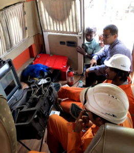
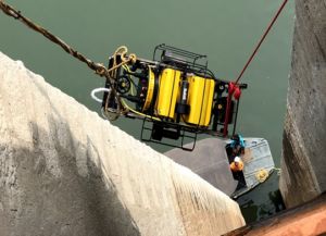
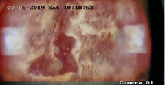
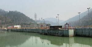
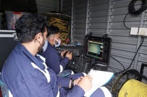
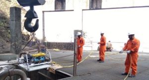
Images show deployment and site setup of the ROV system during inspection

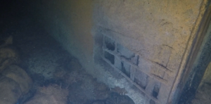
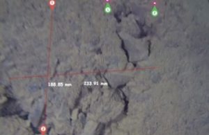
Photographs showing several major defects like rebars exposed, spalling & loss of concrete
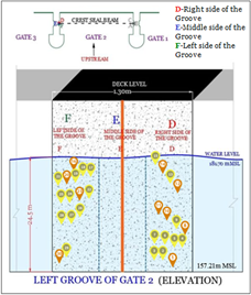
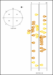
“Hot-spot” map showing concentration of anomalies
CASE STUDY
INSPECTION OF EMERGENCY GATE AND ITS GROOVES
Planys conducted visual inspection of emergency gates and gate grooves of a dam in South India. Due to floods/heavy rains, the water levels in surrounding areas increased thus the time available for inspecting the spillway gate was limited. This also led some areas of the dam become inaccessible which were essential for safe deployment and recovery of ROV.
Scope of Work: Underwater visual inspection of the sluice gate, gate grooves, guide rails, steel plate at the bottom, rubber seal of the intake gate, emergency gate, service gate and spillway gates for determination of defects (corrosion, cracks and obstacles) upto a depth of 35m.
Planys Solution: The inspection was performed using Planys' ROV Mike equipped with high resolution camera and depth sensor.
- Over 15 anomalies were identified and categorised into minor, moderate and major based on the size of the defect that included cracks, debris, suction in some area suggesting leakages, broken grooves, etc
- Planys’ proprietary image enhancement algorithm was used to enhance the videos taken in the extremely turbid waters
- All anomalies/defects were plotted against geo-tagged CAD drawing of every section on the Planys Analytics Dashboard (PAD) with localised click-to-view video feature.
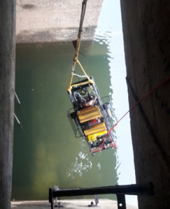
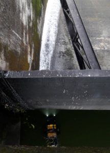
Images show deployment and site setup of the ROV system during inspection
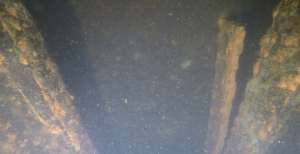
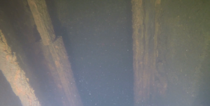
Images show broken gate grooves and broken pieces resting on top of the gate
CASE STUDY
INSPECTION OF UPSTREAM FACE
Planys offered underwater inspection services for the upstream face of a 50-year-old large and crucial dam in West India. The project site had several crocodiles which made manual inspections impossible. ROV Beluga was deployed from a boat for inspection and this vast operation involving over 650 dives was completed smoothly within a 3 weeks’ period.
Scope of Work: Underwater visual inspection of Upstream face of a large dam running across 1100+ m in length of several NOF blocks, power dam blocks consisting of trash racks, T sections, and sluice gates.
Planys Solution: The inspection was performed by Planys' ROV Beluga fitted with high resolution camera, altimeter and depth sensor.
- Over 210 anomalies were identified and categorised into minor, moderate and major based on the size of the defect that included cracks, surface deformations, pinholes and debonding between layers.
- Dimensions of the extent of defects were also extracted using Planys’ unique LASER scaler.
- All anomalies/defects were plotted against geo-tagged CAD drawing of every section on the Planys Analytics Dashboard (PAD) with localised click-to-view video feature.
- The client planned for repair works based on the inspection data submitted by Planys.
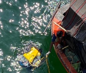
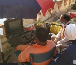
Images show deployment & site setup of the ROV system during inspection
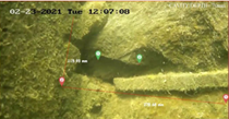
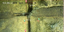
Images show dimensions extracted with Planys ROV of the cracks and debonding between layers from the Visual Inspection of upstream face of dam
CASE STUDY
INSPECTION OF STILLING BASIN
Planys conducted underwater visual inspection and bathymetry of the stilling basin at a 40-year-old dam in south India. This dam is one of the projects under the Ministry of Jal Shakti’s important program called Dam Rehabilitation and Improvement Project (DRIP). ROV Orca was deployed for this project.
Scope of Work: The scope of work included underwater inspection and Bathymetry at stilling basin in extremely muddy and turbid waters.
Planys Solution: The inspection was performed using Planys' ROV Orca equipped with high resolution camera, turbidity module, echo sounder, altimeter and depth sensor.
- About 40 anomalies were identified and categorised into minor, moderate and major based on the size of defect that included cracks, surface deformations, pinholes and debonding between layers.
- Planys’ proprietary image enhancement algorithm was used to enhance the videos taken in the extremely turbid waters
- All anomalies/defects were plotted against geo-tagged CAD drawing of every section on the Planys Analytics Dashboard (PAD) with localised click-to-view video feature.
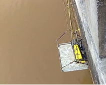
Images show deployment & site setup of the ROV system during inspection
Images of cavity observed after image enhancement
Figure show downstream contour obtained from bathymetry survey at stilling basin
CASE STUDY
INSPECTION OF SPILLWAY AND CELLULAR WALL
Planys conducted underwater visual inspection of a spillway, cellular wall and one intake unit of a critical dam in northeast India.
Scope of Work: Underwater visual of the cellular wall to examine if there are potential sources of leakage from the TRC to ensure smooth functioning of the rehabilitation work and a pre-monsoon maintenance measure. It included inspection of joints on the cellular wall, Tail Race Channel (TRC), stilling basin & stop log grooves.
Planys Solution: The underwater inspection was undertaken using Planys' ROV Orca equipped with high resolution camera, turbid water module, altimeter, and depth sensor.
- Over 90 anomalies were identified and categorised into minor, moderate (60%) and major based on the size of the defects that included cracks, honeycomb formations, surface deformations, pinholes and debonding between layers.
- Dimensions of extent of defects was also extracted using Planys’ unique LASER scaler.
- Planys’ proprietary image enhancement algorithm was used to enhance the videos taken in the extremely turbid waters.
- All anomalies/defects were plotted against geo-tagged CAD drawing of every section on the Planys Analytics Dashboard (PAD) with localised click-to-view video feature. The report was submitted to the client for relevant action points for re-work.
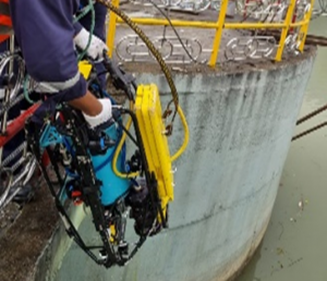
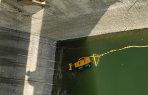
Images show deployment & site setup of the ROV system during inspection
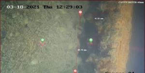
Images showing extracted images of cracks and debonding between layers at cellular walls & grooves with Planys ROV
“Hot-spot” map showing concentration of anomalies
CASE STUDY
INSPECTION OF SURGE SHAFT
Planys conducted underwater visual inspection of concrete wall of surge shaft for an important hydro project in western India. The gallery of the dam had heavy seepage and client suspected the source to be the surge shaft. De-watering the surge tank was not an option. Due to short operational window & higher depth (90m), an ROV was a preferred option.
Scope of Work: Underwater visual inspection of a concrete wall up to a depth of 90m in the surge shaft and grooves of sluice gates at a depth of 50m. The entire inspection was successfully completed in 21 dives.
Planys Solution: The underwater visual inspection was concluded using Planys' ROV Mikros equipped with high resolution camera, altimeter and depth sensor.
- Over 90+ anomalies were identified and categorised by type of defect that included exposure of rebars due to loss of mortar, cavities, cracks, surface deformations, etc.
- Planys ROV Mikros was deployed from the gantry crane and dived upto depths of 90m and inspected the complete perimeter of the surge tank
- Dimensions of extent of defects was also extracted by Planys’ unique LASER scaler.
- All anomalies/defects were plotted against geo-tagged CAD drawing of every section on the Planys Analytics Dashboard (PAD) with localised click-to-view video feature. The report was given to a repair contractor for further relevant action for remedial measures.
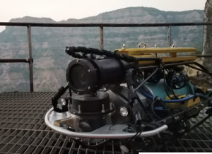
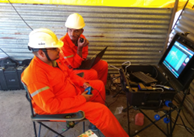
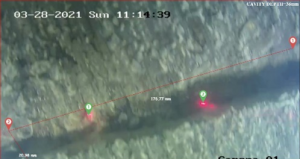
Images show deployment & site setup of the ROV system during inspection
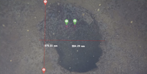
Photos of defects usch as cavities & surface deformations captured by ROV Mikros at depths of 85m
“Hot-spot” map showing concentration of anomalies
CASE STUDY
INSPECTION OF SPILLWAY AND TRASH RACK
Planys conducted underwater visual inspection of several sections of a dam in North India in extremely cold weather making it impossible for human divers to function. The mountain region surrounding the plunge pool had eroded and client wanted to understand the extent of the erosion.
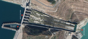
Scope of Work: The scope of work included underwater inspection of spillway structure, trash racks, reservoir gates and piers, decanting chamber, power intake and plunge pool area. It took 160 dives to conclude the entire operation.
Planys Solution: The inspection was performed using Planys' ROV Orca equipped with high resolution camera, altimeter and depth sensor.
- About 90 anomalies were identified and categorised into minor, moderate and major based on the size that included cracks, surface deformations, pinholes and debonding between layers.
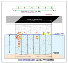
- All anomalies/defects were plotted against geo-tagged CAD drawing of every section on the Planys Analytics Dashboard (PAD) with localised click-to-view video feature. The report helped the client plan repairs and maintenance.
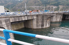
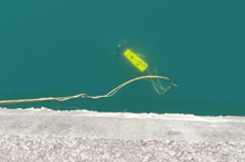
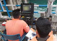
Images show deployment at decantation chamber & site setup of the ROV system during inspection
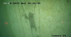
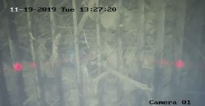
Images show defects like crack on the wall & debris at the trash rack
“Hot-spot” map showing concentration of anomalies
CASE STUDY
BATHYMETRY SURVEY OF A TAIL RACE CHANNEL
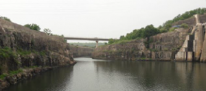
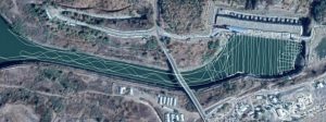
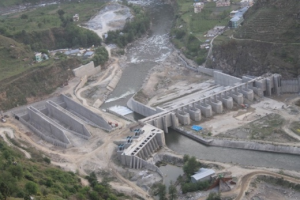
Planys conducted bathymetry survey at Tail Race channel (TRC) of a large dam in Central India to assess the quantity of debris or loose muck in the entire Tail Pool and the TRC. A large deposition of boulders and stones was a cause of concern as it was decreasing the overall water head available to the turbines thus leading to reduced power generation. This survey helped in identifying the presence and quantity of such debris for the client to suitably plan for removal. The TRC was located at a higher altitude than the river and thus traditional bathymetry was not possible.
Scope of Work: Bathymetry survey of a 850m long Tail Race Channel to assess quantity of bounders deposited that lead to lower power generation efficiency. Overall volume of the boulders and the debris was calculated by this survey.
Planys Solution: The inspection was performed using Planys' ROV Beluga equipped with high resolution camera, GPS, side-scan SONAR, altimeter and depth sensor.
- ROV Beluga with a GPS above water and SONAR below water collected the relevant data in a 5x5m grid during the period when the turbines were shutdown
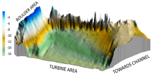
- The data was then filtered, cleaned and computed in the form of a 3D representation for the client. This was then subtracted from the as-built-topology of the TRC and the volumetric difference was computed to be to the tune of 30,000 cubic metre.
- The 3D bathymetry representation was then displayed and geo-tagged on the Planys Analytics Dashboard (PAD) with localised click-to-view video feature.
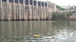
Images show deployment and grid-wise coverage of area by ROV system during survey
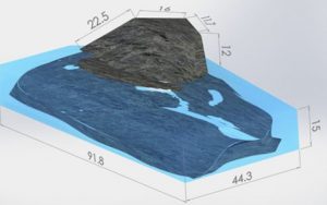
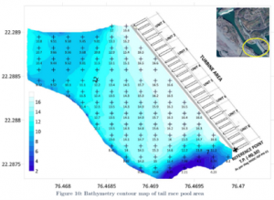
Images show 3D chart of debris, 2D & 3D contour map of the data collected from the bathymetry survey of the TRC
CASE STUDY
UPSTREAM INSPECTION OF TUNNELS AND SURGE TANK
Planys conducted underwater visual inspection of the tail race tunnel (TRT) & surge tank for a hydro project in North India. The client couldn’t send divers as the TRT was a confined region & would pose great risk due to several bends, confined space, limited operational window amidst partial shutdown and extremely turbid waters.
Scope of Work: Underwater visual inspection of upstream tunnel, surge shaft & D-shaped TRT of 5m diameter and 335m length including 3 draft tubes.
Planys Solution: This dam safety inspection was performed using Planys' ROV Orca equipped with high resolution camera, turbid water module, altimeter, and depth sensor.
- ROV Orca was deployed through the surge tank and navigated into the TRT overcoming critical challenges such as several bends at regular intervals in extremely turbid waters.
- Over 30 anomalies were identified and categorised into minor, moderate & major based that included cracks, surface deformations, pinholes and debonding between layers.
- Site engineers (including design team) could see the inspection via live streaming and were able to gauge the extent of the damages.
- Planys’ proprietary image enhancement algorithm was used to enhance the videos shot in the extremely turbid waters
- All anomalies/defects were plotted against geo-tagged CAD drawing of every section on the Planys Analytics Dashboard (PAD) with localised click-to-view video feature.
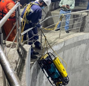
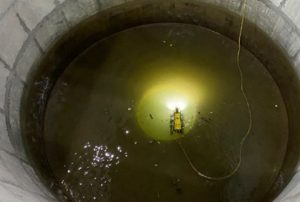
Images show deployment & site setup of the ROV system during inspection
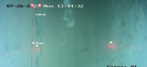
Images show dimensions extracted of cracks and debonding between layers with Planys ROV..
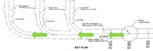
Images showing the coverage of the ROV from the surge tank and other entry points
CASE STUDY
BATHYMETRY SURVEY NEAR UPSTREAM WALL
Planys executed underwater visual inspection of the upstream face and bathymetry survey at a large and crucial dam in South India. The site had crocodiles which made manual inspections impossible. ROV Beluga was deployed from the dam for this inspection and this vast operation involving over 445+ dives and bathymetry survey was meticulously planned and completed smoothly within a 3 weeks’ time period.
Scope of Work: Underwater visual inspection of upstream face of a large dam consisting of 54 blocks to be inspected and bathymetry survey upto 100m from the upstream face.
Planys Solution: The inspection was performed using Planys' ROV Beluga equipped with high resolution camera, GPS, SONAR, altimeter and depth sensor.
- Over 150 anomalies were identified and categorised into minor, moderate and major based on the size of the defect that included cracks, surface deformations, pinholes and debonding between layers.
- Bathymetry was performed by the ROV by breaking the area down into grids of 10x10m
- All anomalies/defects were plotted against geo-tagged CAD drawing of every section on the Planys Analytics Dashboard (PAD) with localised click-to-view video feature.
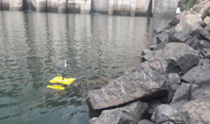
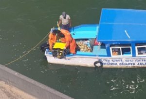
Images show deployment & site setup of the ROV system during inspection
Image shows dimensions extracted with Planys ROV of cavity at one of the blocks of upstream face
Contour map from the bathymetry survey
Bridges
CASE STUDY
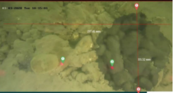
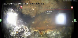
VISUAL INSPECTION OF RAILWAY BRIDGE PIERS
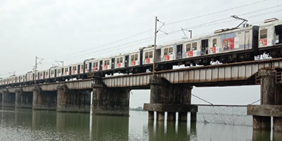
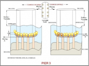
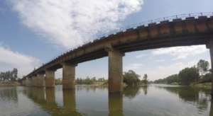
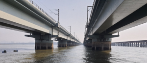
Planys conducted underwater visual inspection at two railway bridges that are over 85+ years old in West India. The inspection aimed to identify damages and deformations that could affect the structural integrity of the bridge piers
Scope of Work: Underwater visual inspection of submerged parts of 4 specific piers.
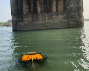
Planys Solution: The inspection was performed using Planys' ROV Mikros equipped with high resolution camera, altimeter and depth sensor.
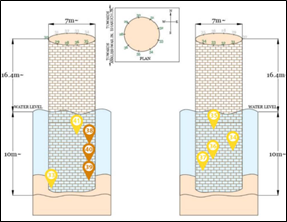
- Over 45 anomalies were identified and categorised into minor, moderate & major based on the size of the defects that included cracks, honeycombing and cavities.
- Planys’ proprietary image enhancement algorithm was used to enhance the videos taken in the extremely turbid waters
- All anomalies/defects were plotted against geo-tagged CAD drawing of every section on the Planys Analytics Dashboard (PAD) with localised click-to-view video.
- The client could take relevant action for repairs and maintenance based on Planys’ findings.
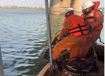
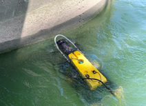
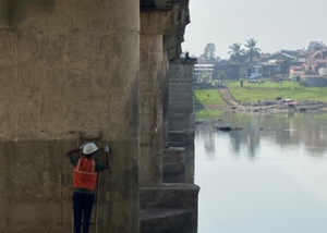
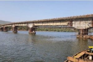
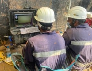
Images show deployment & site setup of the ROV system during inspection
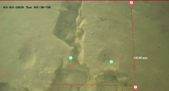
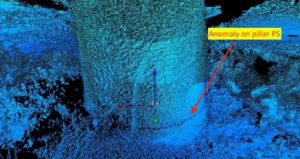
Figures show dimensions extracted
with Planys ROV of cavity, honeycombing and cracks during inspection
“Hot-spot” map showing concentration of anomalies
CASE STUDY
VISUAL INSPECTION (LEVEL 2) OF RAILWAY BRIDGE PILES
Planys conducted underwater visual inspection and cleaning of piles of two railway bridges in West India. The bridges had thick marine growth and was in extremely turbid waters, thus making it impossible for human divers to perform inspection. Further, due to tidal variation, only got a 2-hour window per day was available.
Scope of Work: Level 2 inspection (cleaning and visual inspection) of 39 foundations (with each one being a group 8 piles with pile cap).
Planys Solution: The inspection was performed using Planys' ROV Beluga and ROV Orca equipped with high resolution camera, turbid water module, altimeter, depth sensor & was deployed from a boat.
- Over 100 anomalies were identified and categorised into minor, moderate & major based on the size that included cracks, surface deformations, pinholes, corrosion.
- Site engineers could see the inspection in live streaming and were able to understand the extent of the damages.
- Planys’ proprietary image enhancement algorithm was used to enhance the videos taken in the extremely turbid waters
- All anomalies/defects were plotted against geo-tagged CAD drawing of every section on the Planys Analytics Dashboard (PAD) with localised click-to-view video.
- The report also included customized suggestions for remedial measures to be taken further for repairs.
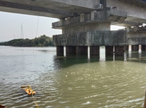
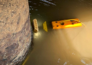
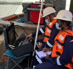
Images show deployment & site setup of the ROV system during inspection
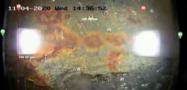
Images show dimensions extracted with Planys ROV of cracks and corrosion during inspection
“Hot-spot” map showing concentration of anomalies
CASE STUDY
STRUCTURAL AUDIT OF WELL FOUNDATION OF HIGHWAY BRIDGE
Planys conducted structural audit of the well foundation of a critical highway bridge in West India. ROV Beluga was deployed for this operation consisting of multiple scope of work and completed in 10 days.
Scope of Work: Complete structural audit of a bridge including underwater visual inspection of 11 Well foundations, UPV test for a total 936 points and chemical tests for 14 points of various parts of a bridge including substructure, slabs and joints.
Planys Solution: The inspection was performed using Planys' ROV Beluga equipped with high resolution camera, turbid water module, altimeter and depth sensor.
- Over 120 anomalies were identified and categorised into minor, moderate & major based on the size of the defects that included cracks, exposed rebars, honeycomb formations, pinholes.
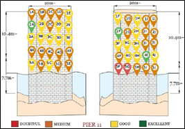
- UPV points taken were categorised as doubtful, medium, good and excellent points as per IS 13311 (Part – 1) – 1992 and chemical tests reported as per IS 2720 (Part 26).
- Planys’ proprietary image enhancement algorithm was used to enhance the videos taken in the extremely turbid waters
- All anomalies/defects were plotted against geo-tagged CAD drawing of every section on the Planys Analytics Dashboard (PAD) with localised click-to-view video.
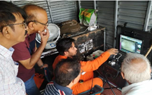
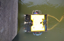
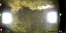
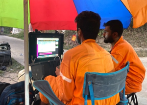
Images show site setup & ROV in action during inspection; UPV of superstructure being taken
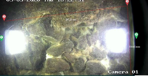
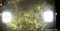
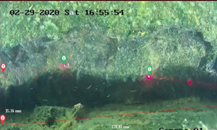
Images show dimensions extracted with Planys ROV of cavity, exposed rebars and corrosion
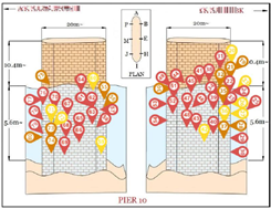
“Hot-spot” map showing concentration of a large number of anomalies on a single well foundation and UPV test observations
CASE STUDY
VISUAL INSPECTION OF BRIDGES IN EXTREMELY TURBID WATERS
Planys conducted underwater visual inspections for a total of nine railway bridges in East India. The bridges were in regions with constant flow of silt, debris & probably industrial discharge. This led to the river being extremely turbid (having zero visibility) hence making it impossible and unsafe for human divers to perform inspection.
Scope of Work: Visual inspection of the submerged sections of 9 bridges consisting of a total of 44 RCC piers.
Planys Solution: The inspection was performed using Planys' ROV Orca equipped with high resolution camera, turbid water module, altimeter and depth sensor.
- Over 320 anomalies were identified and categorised into minor, moderate & major based on the size of the defects that included cracks, cavities, debonding of layers, erosion.
- Planys’ proprietary image enhancement algorithm was used to enhance the videos taken in the extremely turbid waters
- Planys ROV pilot navigated the ROV expertly through the silty river collecting crucial data.
- All anomalies/defects were plotted against geo-tagged CAD drawing of every section on the Planys Analytics Dashboard (PAD) with localised click-to-view video.
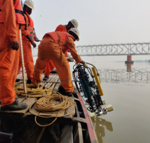
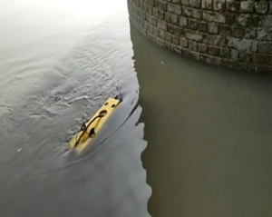
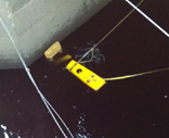
Images show deployment & site setup of the ROV system during inspection
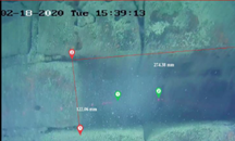
Images show dimensions extracted with Planys ROV of debonding, cavity, and surface deformation during inspection
“Hot-spot” map showing concentration of anomalies
CASE STUDY
VISUAL INSPECTION OF SEA BRIDGE
Planys conducted underwater visual inspection of 12 piers of a 100+ year old iconic sea-bridge in south India. The bridge was undergoing repairs of certain parts and the consultant to the project wanted to check if the 12 piers supporting the lifting spans (that allow small ships to pass through) had any defects/anomalies.
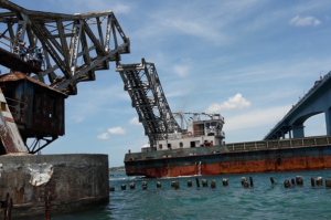
Scope of Work: Visual inspection of the submerged sections of 12 piers supporting the lifting span.
Planys Solution: The inspection was performed using Planys' ROV Beluga equipped with high resolution camera, depth sensor & was deployed from a boat for the inspection.
- Over 10 minor defects were identified that included small cavities & uneven surfaces.
- There were no major defects to the RCC foundation, however the sacrificial steel pile were heavily corroded, broke apart and were lying as debris on the sea floor.
- All anomalies/defects were plotted against geo-tagged CAD drawing of every section on the Planys Analytics Dashboard (PAD) with localised click-to-view video.
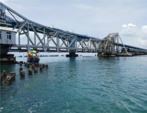
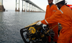
Images show deployment & site setup of the ROV system during inspection
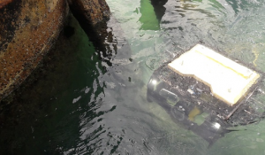
Images shows sacrificial steel debris, found during inspection
“Hot-spot” map showing anomalies at piers
CASE STUDY
VISUAL INSPECTION OF CULVERT FOR LOCAL MUNICIPALITY
Planys conducted underwater visual inspections of a culvert for local municipality in Rotterdam, Netherlands. Usually, the culvert would be emptied by erecting two coffer dams on either side and sending a crawler robot (humans were not allowed to go in due to safety concerns in confined space). These would be very tedious and expensive. A more efficient solution was desired for a preliminary inspection and Planys underwater inspection solution were deployed.
Scope of Work: Visual inspection of the culvert up to 70m length from each side.
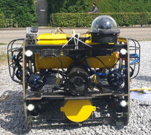
Planys Solution: The inspection was performed using Planys' ROV Beluga equipped with high resolution camera (facing upwards) and depth sensor.
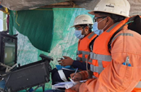
- The ROV system was deployed from the culvert entry point and the cockpit/command module was set up in a mobile van for the client o see the data live
- Minor anomalies were identified like rebars exposed and minor cracks.
- Planys ROV pilot navigated the ROV expertly through the culvert collecting crucial data.
- All anomalies/defects were plotted against geo-tagged CAD drawing of every section on the Planys Analytics Dashboard (PAD) with localised click-to-view video.
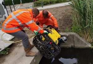
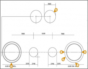
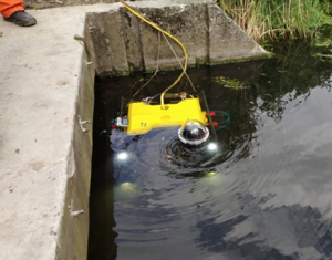
Images show deployment & site setup of the ROV system during inspection of culvert.
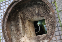
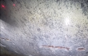
Images show ROV visible from a small hole in the road & re-bars exposed in the culvert top.
“Hot-spot” map showing concentration of anomalies along the culvert with parallel views of front and top camera
CASE STUDY
VISUAL INSPECTION & SONAR SURVEY AT RAILWAY BRIDGE
Planys conducted underwater visual inspection (level 2) of well foundations and bathymetry survey of riverbed for two 40-year-old railway bridges in West India. The bridges had thick marine growth and was in extremely turbid waters, thus making it impossible for human divers to perform inspection. Further, due to tidal variation, only got a 2-hour window per day was available.
Scope of Work: Level 2 inspection (cleaning and visual inspection) of 76 well foundations of 2 railway bridges of 2km of length each and bathymetry survey on either side of the bridges
Planys Solution: The inspection was performed using Planys' ROV Beluga and ROV Orca equipped with high resolution camera, turbid water module, altimeter, depth sensor & was deployed from a boat.
- Over 130 anomalies were identified and categorised into minor, moderate & major based on the size of the defects that included exposed rebars, cracks, honeycombing, surface deformations, pinholes, and corrosion.
- Bathymetry was performed by the ROV at an offset of 30m on each side of the bridge with 5m track line interval.
- Planys’ proprietary image enhancement algorithm was used to enhance the videos taken in the extremely turbid waters
- All anomalies/defects were plotted against geo-tagged CAD drawing of every section and the bathymetry data was presented in 2D and 3D plots on the Planys Analytics Dashboard (PAD) with localised click-to-view video.
- The report also included customized suggestions for remedial measures to be taken further for repairs.
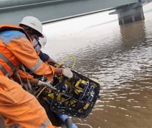
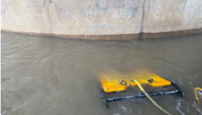
Images show deployment & site setup of the ROV system during inspection
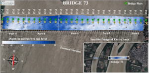
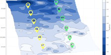
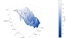
Figures show 2D contour map of the bathymetry survey embedded on satellite image, 2D contour plot and 3D plot of separate sections of the bridges
CASE STUDY
SCOUR SURVEY/MONITORING
Planys conducted underwater visual inspection (level 2) of well foundations and bathymetry survey of riverbed for two 40-year-old railway bridges in West India. The bridges had thick marine growth and was in extremely turbid waters, thus making it impossible for human divers to perform inspection. Further, due to tidal variation, only got a 2-hour window per day was available.
Scope of Work: Level 2 inspection (cleaning and visual inspection) of 76 well foundations of 2 railway bridges of 2km of length each and bathymetry survey on either side of the bridges
Planys Solution: The inspection was performed using Planys' ROV Beluga and ROV Orca equipped with high resolution camera, turbid water module, altimeter, depth sensor & was deployed from a boat.
- Over 130 anomalies were identified and categorised into minor, moderate & major based on the size of the defects that included exposed rebars, cracks, honeycombing, surface deformations, pinholes, and corrosion.
- Bathymetry was performed by the ROV at an offset of 30m on each side of the bridge with 5m track line interval.
- Planys’ proprietary image enhancement algorithm was used to enhance the videos taken in the extremely turbid waters
- All anomalies/defects were plotted against geo-tagged CAD drawing of every section and the bathymetry data was presented in 2D and 3D plots on the Planys Analytics Dashboard (PAD) with localised click-to-view video.
- The report also included customized suggestions for remedial measures to be taken further for repairs.


Images show deployment & site setup of the ROV system during inspection


Figures show 2D contour map of the bathymetry survey embedded on satellite image, 2D contour plot and 3D plot of separate sections of the bridges
CASE STUDY
RIVER BED PROFILING
Planys conducted underwater visual inspection (level 2) of well foundations and bathymetry survey of riverbed for two 40-year-old railway bridges in West India. The bridges had thick marine growth and was in extremely turbid waters, thus making it impossible for human divers to perform inspection. Further, due to tidal variation, only got a 2-hour window per day was available.
Scope of Work: Level 2 inspection (cleaning and visual inspection) of 76 well foundations of 2 railway bridges of 2km of length each and bathymetry survey on either side of the bridges
Planys Solution: The inspection was performed using Planys' ROV Beluga and ROV Orca equipped with high resolution camera, turbid water module, altimeter, depth sensor & was deployed from a boat.
- Over 130 anomalies were identified and categorised into minor, moderate & major based on the size of the defects that included exposed rebars, cracks, honeycombing, surface deformations, pinholes, and corrosion.
- Bathymetry was performed by the ROV at an offset of 30m on each side of the bridge with 5m track line interval.
- Planys’ proprietary image enhancement algorithm was used to enhance the videos taken in the extremely turbid waters
- All anomalies/defects were plotted against geo-tagged CAD drawing of every section and the bathymetry data was presented in 2D and 3D plots on the Planys Analytics Dashboard (PAD) with localised click-to-view video.
- The report also included customized suggestions for remedial measures to be taken further for repairs.


Images show deployment & site setup of the ROV system during inspection


Figures show 2D contour map of the bathymetry survey embedded on satellite image, 2D contour plot and 3D plot of separate sections of the bridges
CASE STUDY
RIVER BED PROFILING
Planys conducted underwater visual inspection, sounding and 3D SONAR survey of a critical highway bridge in West India. The bridges piers had been severely scoured around the bed over the past 50 years exposing the bed-rock thus making it impossible for human divers to perform inspection (depth ~ 20m). Further, one the piers in the middle of the bridge had tilted and an urgent inspection was recommended to evaluate the extent of damage and plan rehabilitation accordingly.
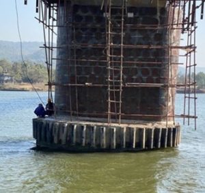
Scope of Work: Visual Inspection, sounding and 3D SONAR survey of 6 piers
Planys Solution: The inspection was performed using Planys' ROV Orca equipped with high resolution camera, echosounder, 3D SONAR, depth sensor & was deployed from a boat.
- Over 90 anomalies were identified and categorised into minor, moderate & major based on the size that included cracks, surface deformations, pinholes, corrosion.
- It was found that one of the piers alone had more than 50% of the observed anomalies and had heavy scouring at bed (bed rock exposed), hence tilting it sideways. The pier also had a large horizontal crack at the bottom at a water depth of 20m. This was verified in both visual inspection and 3D SONAR survey.
- Site engineers could see the inspection in live streaming and were able to understand the extent of the damages.
- Planys’ proprietary image enhancement algorithm was used to enhance the videos taken in the extremely turbid waters
- All anomalies/defects were plotted against geo-tagged CAD drawing of every section on the Planys Analytics Dashboard (PAD) with localised click-to-view video.
- Due to the high risk and as a precaution, the authorities closed down the bridge
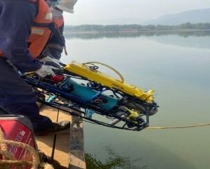
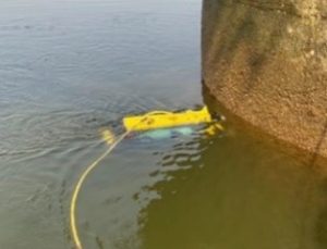
Images show deployment & site setup of the ROV system during inspection
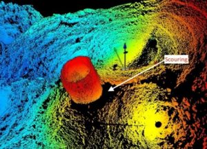
3D SONAR image showing horizontal crack and extent of Scour
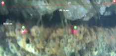
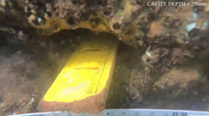
“Hot-spot” map showing anomalies on the damaged pier the bridge
Process Plants
CASE STUDY
INTERNAL INSPECTION OF OUTFALL PIPELINE FOR FERTILIZER PLANT
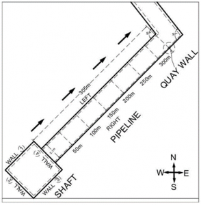
Planys performed underwater inspection for an outfall buried pipeline for a fertilizer and industrial chemical plant. In a neighbouring field (through which the pipeline goes), heavy leakage was observed. An externally installed quay wall was suspected to have pierced through the buried pipeline, thus causing heavy leakage. The distance between the point of entry of the pipeline to the suspected location of damage was 310m away thus making it inaccessible for any diver based inspection without taking shutdown and dewatering the entire pipeline. Thus, Planys ROV was called in to inspect the pipeline without dewatering it.
Scope of Work: Underwater visual inspection to identify cause of the damage to the outfall pipeline (upto 310m length) and also assess its general condition.
Planys Solution: The inspection was performed using Planys' ROV Orca fitted with high resolution camera, altimeter and depth sensor.
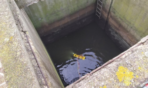
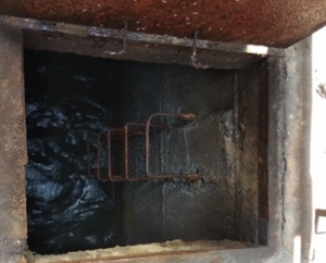
- The ROV was deployed through the manhole using a crane and navigated through the length of the pipeline where it found the quay wall that pierced the pipeline.
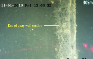
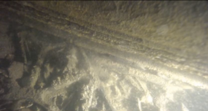
- The findings indicated the presence of a section of the quay wall (0.5 m wide x 6 m length) protruding inside the pipeline at a distance of 305 m from the deployment point.
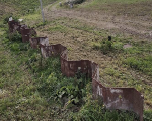
- The terminating edge of the quay wall was clearly identified and also correlated to the above ground pictures of the quay wall sheet pile structure.
- The rest of the pipeline sections were found to be normal
- All anomalies/defects were plotted against geo-tagged CAD drawing of every section on the Planys Analytics Dashboard (PAD) with localised click-to-view video.
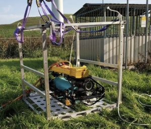
Photos showing deployment of the ROV and while entering the pipeline from the top
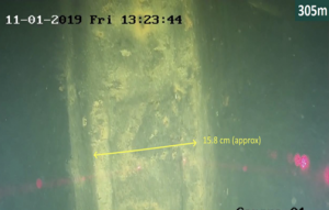
Underwater images of quay wall found inside the pipelines
CASE STUDY
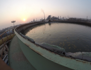
OPEN-ROOF STORAGE TANK (FIRE WATER, POTABLE, DM)
Planys conducted underwater inspection for an open-roof fire water tank in an oil and gas refinery. Internal concrete lining of the tank had collapsed on the top side. The client wanted to plan the maintenance better and thus without taking a shutdown and without dewatering, they wanted to inspect the fire-water tank.
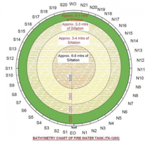
Scope of Work: The scope of work included visual inspection of a tank of diameter 20m and height 15m. The inspection aimed to identify extent of damage to the internal concrete lining. Additionally, computation of silt accumulation at the bottom was desired.
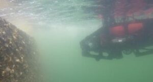
Planys Solution: The inspection was performed using Planys' ROV Mike equipped with high resolution camera, turbid water module and depth sensor.
- Only 10 defects were identified on the internal lining and were categorised by severity (moderate/minor) and also by type (crack/spalling) and marked on the tank drawing.
- Since the water was from the creek nearby, Planys’ turbid water module was used along with its proprietary image enhancement software to reduce cloudiness in the videos.
- Dimensions of cracks were also extracted using LASER scaling module on Planys ROV.
- ROV Mike also assessed the silt levels & 25% of the tank was found to be filled with silt. Apart from a maintenance issue, this was also a safety issue as this tank only had 75% fire-water.
- Overall, the tank was in good condition and this helped the client inform the repair contractor to appropriately plan. It also brought down the shutdown period by 75%.
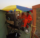
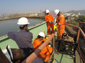
Images show deployment & setup of the ROV system and defects captured during inspection
Images show defects captured during inspection with Planys ROV & snapshot of the “defects hot-spot” map delivered to client for a certain section on Planys Analytics Dashboard (PAD)
CASE STUDY
INSPECTION OF A PORT
(a) ROV Mike inspecting structure (b) As-constructed vs damaged analysis
(c) Snapshot of Planys Assessment Dashboard and defects identified
Conventionally this job would have been done by use of Divers. Divers will not have the endurance that Planys ROVs has and will take more time to get same amount of data. They will have difficulties working in high depths as the pressure keeps increasing. Planys ROVs are designed to work till a depth of 200m.

CASE STUDY
CLOSED-ROOF STORAGE TANK (FIRE WATER, POTABLE, DM)
Planys conducted underwater inspection for a closed-roof potable water storage tank inside a Petro-chemical plant. Since construction, the tank was never inspected due to other priorities during shutdowns. The client wanted to inspect the tank in online conditions (without de-watering) to pro-actively plan for the upcoming shutdown & maintenance.
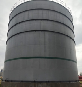
Scope of Work: Underwater visual inspection of a tank shell & roof (diameter 25m and height 18m) and wall thickness measurement of tank floor/base plate in live/online (without taking shutdown or de-watering) condition.
Planys Solution: The inspection was performed using Planys' ROV Orca equipped with high resolution camera, ultrasonic thickness (UT) measurement probe mounted on a gimbal, altimeter and depth sensor.
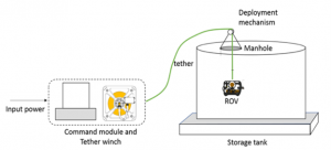
- Deployed through the roof manhole, ROV Orca covered the shell in grid of 2m spacing.
- Gimbal mounted UT probe was placed on the belly of the ROV and collected very reliable/repeatable data for bottom plate thickness
- Defects identified were categorised by severity (moderate/minor) & along with UT measurements were geo-tagged on the tank drawing visible through the Planys Analytics Dashboard (PAD).
- Overall, the tank was in pristine condition and this helped the client take a decision to completely fore-go the planned upcoming shutdown thus saving time, cost and resources.
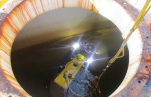
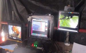
Images show ROV deployment & setup and bottom camera feed while taking UT readings
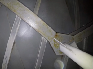
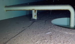
Images show minor corrosion captured on the roof, near the sump and on the shell of the tank;
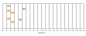
Tank floor CAD drawing with UT measurements geo-tagged against position within the tank
CASE STUDY
SIDE SCAN SONAR SURVEY IN HIGH VELOCITY INTAKE OPEN WATER CANAL FOR THERMAL POWERPLANT
Planys conducted underwater SONAR survey for a section of an intake water canal for a thermal power plant. The canal wall collapsed into the canal and the contractor hired for its rehabilitation wanted to assess the extent of the debris in the canal and geo-tag the locations for concerns on a map for further action. Thermal plant owners did not want to take a shutdown and thus the canal had high velocity (more than 5 m/s) of continuous flow of water. An ROV was chosen as the safe option compared to divers.
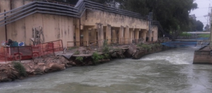
Scope of Work: Conditions assessment of the damages to canal wall using Side-Scan SONAR for 60m of stretch to identify the location of debris lying on the canal bed and compute the extent of the spread of debris.
Planys Solution: The underwater inspection services were performed using Planys' Remotely Operated Vehicle (ROV) Beluga equipped with high end Side-Scan SONAR, GPS, altimeter and depth sensor.
- Due to high flow in the canal, the ROV was tied with 4 high tensile ropes and suspended into the channel.
- SIDE SCAN SONAR imaging for the areas of interests (in a grid pattern) was completed and anomalies were geo-tagged against the CAD drawing
- Figures below shows the swath covered by Side-scan SONAR system and the location of major objects observed around the berth. Results were finally tabulated and compiled on the Planys Analytics Dashboard (PAD).
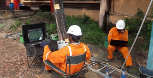
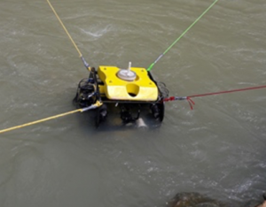
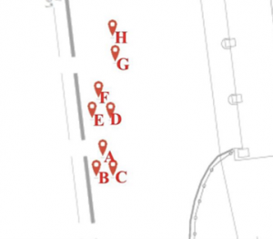
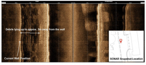
Some Side Scan SONAR images identifying objects at the canal-bed supplemented by visual inspection
CASE STUDY
COLD WELL TANK & WATER BASIN/ SUMP INSPECTION
Planys conducted underwater inspection of a cold well tank & water basin at a steel plant. The inspection aimed at monitoring the health conditions of the structures and to identify defects or anomalies which poise threat to plant operations. Since commissioning the tank, this was the first inspection that was conducted without taking shutdown (in online conditions with pumps running).
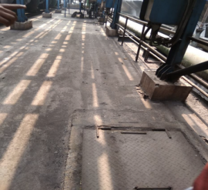
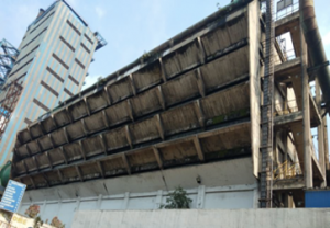
Scope of Work: The scope of work included visual inspection of 5 sections of the tank of total 100m by 50m and 8 metres deep. The inspection aimed to identify locations of structural defects, debris at the bottom and overall assess the health conditions.
Planys Solution: The inspection was performed using Planys' ROV Mike in online conditions (with pumps running) equipped with high resolution camera, turbid water module, altimeter and depth sensor.
- ROV Mike was deployed through the manhole and found over 25+ anomalies comprising of cavity, cracks, & debris and categorised by severity (major/moderate/minor).
- A lot of construction debris (rebar, ladders, discarded cans) were found at the base that could choke the pumps and create downtimes for the client.
- All anomalies/defects were plotted against geo-tagged CAD drawing of every section on the Planys Analytics Dashboard (PAD) with localised click-to-view video feature.
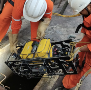
Images show deployment & setup of the ROV system and defects captured during inspection
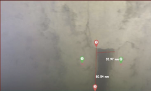
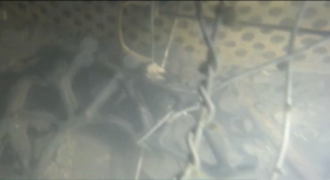
Images show defects and debris captured during inspection with Planys ROV
CASE STUDY
INTERNAL INSPECTION OF INTAKE PIPELINE FOR THERMAL PLANT
Planys conducted underwater inspection of an intake pipeline for a desalination plant in India. The overall in-flow rate of water has reduced and the client wanted to understand the reason for the same. Due to lack of enough man holes in the pipeline, manual diver based inspection was risky. Alternatively, de-watering was not feasible due to the costs and downtime involved and Planys ROV based inspection was desired as it would offer a safe-unmanned solution without the need to de-water the pipeline.
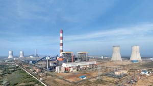
Scope of Work: Underwater visual inspection to identify cause of low flow rate and assess its general condition.
Planys Solution: The inspection was performed using Planys' ROV Mike equipped with high resolution camera and depth sensor.
- ROV Mike was deployed from the plant side man hole, sea-side manhole and from other manholes in the middle.
- It navigated on both sides of the pipeline taking videos to assess the health.
- Heavy deposits of marine growth (barnacle, scallops) were found adhered to the internal surface of the pipeline thus reducing effective cross section area and flow rate.
- All data sets were plotted against geo-tagged CAD drawing of every section on the Planys Analytics Dashboard (PAD) with localised click-to-view video.
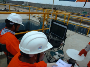
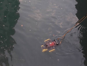
Photographs of ROV Mike being deployed from the plant-side sea basin
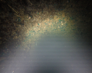
Photographs captured by ROV Mike of heavy marine growth formation on the internal lining of the pipeline.
CASE STUDY
WASTEWATER PLANTS
Planys conducted underwater inspection of an intake pipeline for a desalination plant in India. The overall in-flow rate of water has reduced and the client wanted to understand the reason for the same. Due to lack of enough man holes in the pipeline, manual diver based inspection was risky. Alternatively, de-watering was not feasible due to the costs and downtime involved and Planys ROV based inspection was desired as it would offer a safe-unmanned solution without the need to de-water the pipeline.

Scope of Work: Underwater visual inspection to identify cause of low flow rate and assess its general condition.
Planys Solution: The inspection was performed using Planys' ROV Mike equipped with high resolution camera and depth sensor.
- ROV Mike was deployed from the plant side man hole, sea-side manhole and from other manholes in the middle.
- It navigated on both sides of the pipeline taking videos to assess the health.
- Heavy deposits of marine growth (barnacle, scallops) were found adhered to the internal surface of the pipeline thus reducing effective cross section area and flow rate.
- All data sets were plotted against geo-tagged CAD drawing of every section on the Planys Analytics Dashboard (PAD) with localised click-to-view video.


Photographs of ROV Mike being deployed from the plant-side sea basin

Photographs captured by ROV Mike of heavy marine growth formation on the internal lining of the pipeline.
Our Clients Speak
Why Choose Us?
Safe & Unlimited Endurance
Planys ROVs are unmanned thus safe and can operate for prolonged periods
Work in Hostile Conditions
We work in hazardous & inaccessible & confined areas (without taking shutdown)
Advanced Underwater NDT
We offer novel non-destructive testing solutions that are unavailable globally
Digital Reporting Dashboard
AI-enabled intelligent analytics & digital reporting for data-driven decision making
Enhanced Accuracy
We provide accurate, reliable and repeatable data
Data Enhancement
We devise & use best-in-class data enhancement tools for superior client experience
Domain Knowledge
We have strong multidisciplinary domain expertise & field experience
Indigenously Developed
Our technology is designed & developed in India, echoing with ‘Make in India’
Accreditations
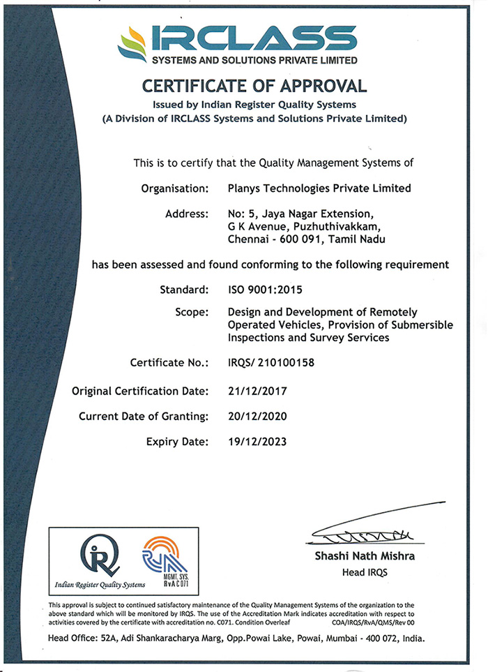
ISO 9001:2015
Planys is a quality driven organization, and all our organizational processes are governed by the ISO 9001:2015 quality management system. To evolve as a global leader and for a sustainable scale-up, we adopted the standards just in the third year since the inception. Planys has been successfully certified since 2017 and continues to follow the principles of continual and sustained improvements.
RINA
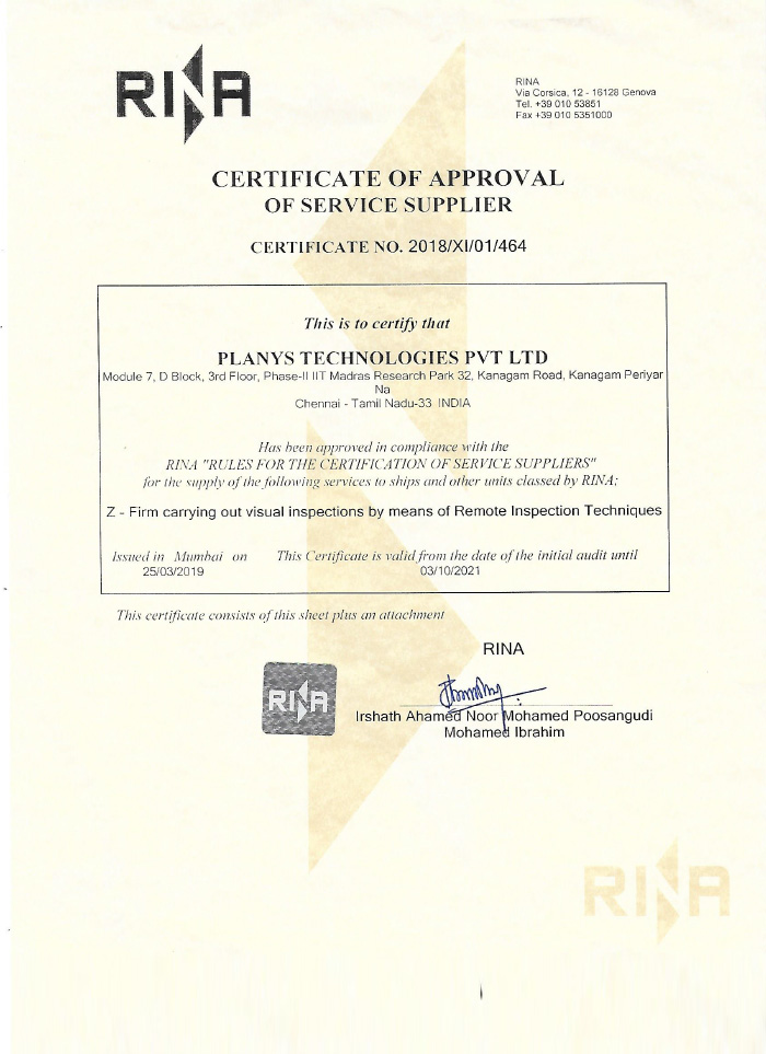
Planys is an authorized service supplier certified by the classification society RINA for underwater inspection in lieu of dry-dock (UWILD). The certification covers the scope of visual inspection and ultrasonic testing using remotely operated underwater vehicles (ROVs).
