
Planys conducted underwater SONAR survey for a berth at a finger jetty in South India. As an aftermath of cyclone Vardah that hit the eastern coast of India in early December 2016, it was suspected that the wrecked sunken remains of moderate to large size would have accumulated at the finger jetty. The survey was aimed at identifying sunken objects and major obstacles on the sea-bed close to the finger jetty and geo-tag the locations for concerns on a map for further action by the client.
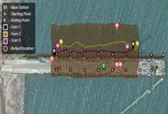
Scope of Work: Visual inspection for identifying any medium to large unwanted sunken objects and abnormalities on the seabed profile around the finger jetty. The scope of work included Side Scan imaging of the berth at finger jetty up to a distance of 10m on both northern and southern side of the platform.
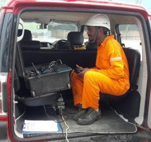
Planys Solution: The survey was performed using Planys’ Remotely Operated Vehicle (ROV) Beluga equipped with high end Side-Scan SONAR, GPS, altimeter and depth sensor.
- Acoustic imaging for the areas of interests was completed using ROV Beluga.
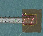
- Figures below show the swath covered by Side-scan SONAR system and the location of major objects observed around the berth.
- Results were finally tabulated and compiled on the Planys Analytics Dashboard (PAD).
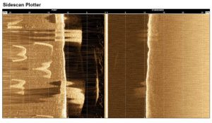
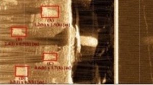
Some Side Scan SONAR images : Objects at the seabed, in between the piles, towards port side at 11.3m of depth